Jump to : Simplicity, Richness, Performance, Interoperability, Mobile & web


GIS ANYONE CAN USE
Simplicity of use is GEOCONCEPT's first mantra


An intuitive interface for outstanding user experience

Built using the latest Microsoft Office User Interface, GEOCONCEPT 7 enables every user to feel at home at first sight. The interface offers direct access to a large number of simplified functions. For tablet use, a beautifully designed touch mode gives friendly access to all primary functions.
 
Focus on our new touch mode : for tablet use, a beautifully designed touch mode gives friendly access to all primary functions.

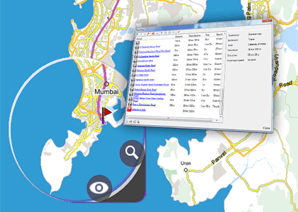
Easy yet powerful access to information

Want to find the 10 largest green areas within districts with population density above 100,000 people per sq mile? Our query system brings you the answer in 3 clicks. List and layers management systems offer users best-in-class customization possibilities within an intuitive framework.


Focus on our unified query system : with Geoconcept, you can also create dialogue boxes for saved queries, to make queries simpler and more interactive.
 

"We are proud to say we have made geographic insight accessible to any decision-maker."


Want to know how? Try it now!
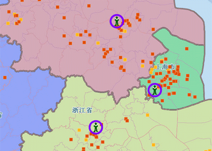
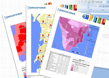

FEATURE-RICH GIS


A complete array of advanced functionalities increase productivity and bring new angles of analysis to every users.

GEOCONCEPT blends traditional GIS functions with advanced applications such as 3D, Routing, online Geocoding, and 4D, within a single environment.


Routing

Geoconcept comes with a state-of-the-art routing module which includes functions such as isochrones, distance matrix or proximity search.

Learn more about the routing module


Geocoding

Our geocoding engine is one of the most powerful on the market.
Geocoding is integrated as component in the enterprise version.
The software also contains integrated links to our web services for demanding applications such as bulk-geocoding.

Learn more about Geoconcept Universal Geocoder


3D

Our 3D module contains an advanced graphical engine.

It includes features as diverse as 3D thematic display, line of sight computation, DTM creation, or camera navigation mode.

Learn more about our 3D engine


4D

Our innovative 4D feature enables users to visualize their data dynamically, following time series or another variable of choice.

Learn more about 4D feature


Publishing

Geoconcept offers a whole
range of publishing options
from traditional map publishing functions to complex report editions,
with diversified data representation possibilities.
 

learn more about our reporting tool


HIGH PERFORMANCE AT THE CORE
Our technology is fast, consistent, and reliable.


First designed at a time when every byte mattered, today's GEOCONCEPT kernel exhibits matchless performance levels.


GEOCONCEPT sets the standard in terms of speed of display and computation. Our technology is used by several countries for high traffic web cartographic portals, such as geoportail
 

www.geoportail.fr


From version 1.0 in 1990 to version 7.2 in June 2013 GEOCONCEPT is continuously been improved and upgraded, insuring that our users have the most advanced technology at their disposal.


INTEROPERABILITY AT ITS BEST

The most complete Import and Export possibilities

GECOCONCEPT enables easy integration of any map or database format thanks to a simple drag-and-drop interface.Temporary and permanent links can be configured thanks to integrated Oracle, OLE DB, and GDAL libraries.


Export in Google Earth
Geoconcept includes a wizard dedicated to export in kmz format, to send content directly to Google earth, right the way you want to view it.


Interactions with other applications is a child's play

GEOCONCEPT is designed to communicate with wms (web map service) servers including Bing maps and Open Street Map, enabling the display of background maps inside the software. GECOCONCEPT also allows direct interaction with other Google applications such as street-view, or sketch-up.


ActiveX Control
Geoconcept comes with GeoXplorer, an ActiveX control that enable users to display a map inside other applications such as Microsoft Powerpoint.


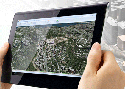
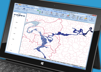
MOBILITY : WORK WITH YOUR CONTENT ANYWHERE YOU WANT

Geoconcept enables rapid exchange and diffusion of Information thanks to web and mobile publishing functions.


WEB

Put your maps online !

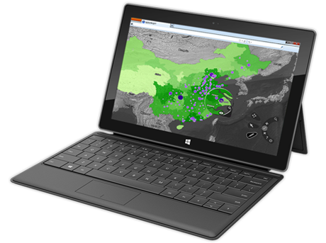
GEOCONCEPT allows users to publish or update a map online in a few clicks via a simple online publishing wizard.

GEOCONCEPT has also developed a cartographic website builder, EasyGeoWeb, which allows non-specialist users to rapidly design and create cartographic applications for internet and intranet.
 

MOBILITY

Compatibility with Mobile devices

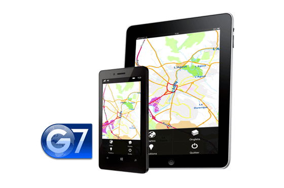
GEOCONCEPT GIS environment is compatible with Windows 8 and can be used on new generation of windows pro laptops and tablets.

GEOCONCEPT MOBILE, presently available with Android and IOS, enables user in the field to work with their content, both in connected and disconnected modes. Users can configure and push maps from their desktop and download and open them on their mobile.